
Latest Version
Version
1.0
1.0
Update
September 25, 2025
September 25, 2025
Developer
XDivide Geospatial
XDivide Geospatial
Categories
Travel & Local
Travel & Local
Platforms
Android
Android
Downloads
0
0
License
$0.99
$0.99
Package Name
com.xd_geospatial_nz.stewart_island
com.xd_geospatial_nz.stewart_island
Report
Report a Problem
Report a Problem
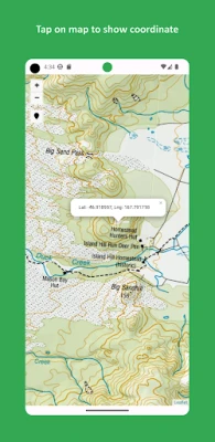
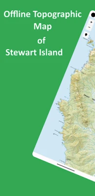
More About Stewart Island Offline Topo
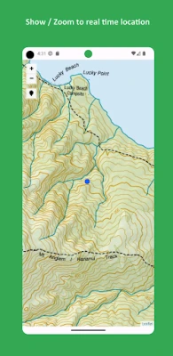
Designed with simplicity in mind, this app offers an intuitive user interface that enables you to quickly and easily find information about surroundings, without any prior technical knowledge or experience.
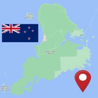
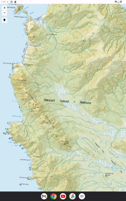
The app offers offline topographic map of Stewart Island, meticulously provided and maintained by LINZ (Land Information New Zealand) - the NZ official agency entrusted with storing and maintaining the country's title and survey records, with the aim of aiding in understanding, developing and caring for whenua, moana and arawai.
As a testament to our commitment to utilizing cutting-edge technology, we proudly leverage the Leaflet JavaScript library – a project born in Ukraine. It delivers a seamless user experience that empowers you to explore and discover the world with ease.
This app is the embodiment of our unwavering commitment to making the world a better place, and we are honored to provide a powerful platform that equips you with the tools and information needed to navigate and explore the surroundings with confidence and clarity.
Rate the App
Add Comment & Review
User Reviews
Based on 0 reviews
No reviews added yet.
Comments will not be approved to be posted if they are SPAM, abusive, off-topic, use profanity, contain a personal attack, or promote hate of any kind.


More »

Popular Apps

Shadow Fight 2 Special EditionNEKKI

MentorPROMentorPRO

Mentor DSP by eDriving℠eDriving, LLC

PHH MortgageQuestionsPHH Mortgage Corporation

Uzbekistan TourismBEKA INDUSTRIES LTD.

School Teacher Student GameFun Bytes Studio

Vrbo Vacation RentalsVrbo

My ArlingtonCommon-Area LLC

Mentor TRADE EXPERTEducation Tree Media

GraalOnline EraGRAALONLINE
More »
Editor's Choice

Bunny Hop - Cute Bunny GameZorse

Add OneGreen Snake Games
Color Wood Jam - Block PuzzleOne Way Street

Chime – Mobile BankingChime

Dusted CharmCommentSold Apps III

Remove Objects - Photo & Videoo16i Apps

AniEraser - Object RemoverShenzhen Wondershare Software Co., Ltd.

Professor IndexProfessor Index

Professor EvolutionPlusOnVirtualGym

LS ProfessorOtimize-TI Tecnologia Otimizando Negocios